
 | Koordinatenbezugssystem |
 | Coordinate Reference System |
 | Système de coordonnées de référence |
| Item | SPF | XML | Change | Description | IFC2x3 to IFC4 4.0.0.0 |
|---|---|---|---|---|
| IfcCoordinateReferenceSystem | ADDED |
The IfcCoordinateReferenceSystem is a definition of a coordinate reference system by means of qualified identifiers only. The interpretation of the identifier is expected to be well-known to the receiving software.
NOTE Definition from OpenGIS Abstract Specification, Topic 2:
A coordinate reference system is a coordinate system which is related to the real world by a datum. The coordinate system is composed of a set of coordinate axes with specified units of measure. The datum specifies the relationship of a coordinate system to the earth. The resulting combination of coordinate system and datum is a coordinate reference system.
The unambiguous identifier by which the coordinate reference system is know, is stored in the Name attribute. Well defined identifiers include the geodetic and often also the vertical datum. In these cases the GeodeticDatum and the VerticalDatum can be omitted.
EXAMPLE The identifier 'EPSG:25832' defines the geodetic datum 'ETRS89' in additon to the projection and the zone. 'EPSG:5555' defined the geodetic datum 'ETRS89' and the vertical datum 'DHHN92'.
NOTE One widely-used, publicly-available authority is the European Petroleum Survey Group (EPSG), and use of this authority is currently specified in several OGC Implementation Specifications. Software used to transport IFC engineering models into GIS applications (and vice versa) is expected to have knowledge about the OGC Implementation Specifications.
HISTORY New entity in IFC4.
| # | Attribute | Type | Cardinality | Description | G |
|---|---|---|---|---|---|
| 1 | Name | IfcLabel | ? |
Name by which the coordinate reference system is identified.
NOTE 1 The name shall be taken from the list recognized by the European Petroleum Survey Group EPSG. It should then be qualified by the EPSG name space, for example as 'EPSG:5555'. NOTE 2 The name shall be 'WKT' if an EPSG code does not exist for the CRS. | X |
| 2 | Description | IfcText | ? |
Informal description of this coordinate reference system
NOTE In case Name equals 'WKT' the Description is well-known text that corresponds to ISO 19162 definition specifying the necessary parameters for the coordinate reference system. Example for ellipsoid: ELLIPSOID[<name>,<major axis>,<inverse flattening>,<length unit>] | X |
| 3 | GeodeticDatum | IfcIdentifier | ? |
Name by which this datum is identified. The geodetic datum is associated with the coordinate reference system and indicates the shape and size of the rotation ellipsoid and this ellipsoid's connection and orientation to the actual globe/earth. It needs to be provided, if the Name identifier does not unambiguously define the geodetic datum as well.
EXAMPLE geodetic datums include: | X |
| HasCoordinateOperation | IfcCoordinateOperation @SourceCRS | S[0:1] | Indicates conversion between coordinate systems. In particular it refers to an IfcCoordinateOperation between this coordinate reference system, and another Geographic coordinate reference system. | X | |
| WellKnownText | IfcWellKnownText @CoordinateReferenceSystem | S[0:1] | Well Known Text (WKT) definition for this coordinate reference system inversely associated as a IfcWellKnownText entity. | X |
| Rule | Description |
|---|---|
| NameOrWKT | Ensures that the coordinate reference system is properly specified by either a reference to an EPSG code in Name or a well known text in WellKnownText. |
| # | Attribute | Type | Cardinality | Description | G |
|---|---|---|---|---|---|
| IfcCoordinateReferenceSystem | |||||
| 1 | Name | IfcLabel | ? |
Name by which the coordinate reference system is identified.
NOTE 1 The name shall be taken from the list recognized by the European Petroleum Survey Group EPSG. It should then be qualified by the EPSG name space, for example as 'EPSG:5555'. NOTE 2 The name shall be 'WKT' if an EPSG code does not exist for the CRS. | X |
| 2 | Description | IfcText | ? |
Informal description of this coordinate reference system
NOTE In case Name equals 'WKT' the Description is well-known text that corresponds to ISO 19162 definition specifying the necessary parameters for the coordinate reference system. Example for ellipsoid: ELLIPSOID[<name>,<major axis>,<inverse flattening>,<length unit>] | X |
| 3 | GeodeticDatum | IfcIdentifier | ? |
Name by which this datum is identified. The geodetic datum is associated with the coordinate reference system and indicates the shape and size of the rotation ellipsoid and this ellipsoid's connection and orientation to the actual globe/earth. It needs to be provided, if the Name identifier does not unambiguously define the geodetic datum as well.
EXAMPLE geodetic datums include: | X |
| HasCoordinateOperation | IfcCoordinateOperation @SourceCRS | S[0:1] | Indicates conversion between coordinate systems. In particular it refers to an IfcCoordinateOperation between this coordinate reference system, and another Geographic coordinate reference system. | X | |
| WellKnownText | IfcWellKnownText @CoordinateReferenceSystem | S[0:1] | Well Known Text (WKT) definition for this coordinate reference system inversely associated as a IfcWellKnownText entity. | X | |
 <xs:element name="IfcCoordinateReferenceSystem" type="ifc:IfcCoordinateReferenceSystem" abstract="true" substitutionGroup="ifc:Entity" nillable="true"/>

 <xs:complexType name="IfcCoordinateReferenceSystem" abstract="true">

  <xs:complexContent>

   <xs:extension base="ifc:Entity">

    <xs:sequence>

     <xs:element name="HasCoordinateOperation" type="ifc:IfcCoordinateOperation" nillable="true" minOccurs="0" maxOccurs="1"/>

    </xs:sequence>

    <xs:attribute name="Name" type="ifc:IfcLabel" use="optional"/>

    <xs:attribute name="Description" type="ifc:IfcText" use="optional"/>

    <xs:attribute name="GeodeticDatum" type="ifc:IfcIdentifier" use="optional"/>

   </xs:extension>

  </xs:complexContent>

 </xs:complexType>
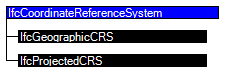
ENTITY IfcCoordinateReferenceSystem
ABSTRACT SUPERTYPE OF(ONEOF(IfcGeographicCRS, IfcProjectedCRS));
Name : OPTIONAL IfcLabel;
Description : OPTIONAL IfcText;
GeodeticDatum : OPTIONAL IfcIdentifier;
INVERSE
HasCoordinateOperation : SET [0:1] OF IfcCoordinateOperation FOR SourceCRS;
WellKnownText : SET [0:1] OF IfcWellKnownText FOR CoordinateReferenceSystem;
WHERE
NameOrWKT : (HIINDEX(WellKnownText) = 1) OR EXISTS(Name);
END_ENTITY;
 References: IfcCoordinateOperation
IfcWellKnownText
IfcCoordinateReferenceSystemSelect
References: IfcCoordinateOperation
IfcWellKnownText
IfcCoordinateReferenceSystemSelect
 EXPRESS-G diagram
 Link to this page