
| # | Attribute | Type | Cardinality | Description | G |
|---|---|---|---|---|---|
| 9 | FactorX | IfcReal | Factor X by which the length measures in local engineering CS have to be multiplied to get map coordinates | X | |
| 10 | FactorY | IfcReal | Factor Y by which the length measures in local engineering CS have to be multiplied to get map coordinates | X | |
| 11 | FactorZ | IfcReal | Factor Z by which the length measures in local engineering CS have to be multiplied to get map coordinates | X |
| # | Attribute | Type | Cardinality | Description | G |
|---|---|---|---|---|---|
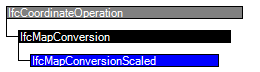
| IfcCoordinateOperation | |||||
| 1 | SourceCRS | IfcCoordinateReferenceSystemSelect | Source coordinate reference system for the operation. | X | |
| 2 | TargetCRS | IfcCoordinateReferenceSystem | Target coordinate reference system for the operation. | X | |
| IfcMapConversion | |||||
| 3 | Eastings | IfcLengthMeasure |
Specifies the location along the easting of the coordinate system of the target map coordinate reference system.
NOTE for right-handed Cartesian coordinate systems this would establish the location along the x axis. | X | |
| 4 | Northings | IfcLengthMeasure |
Specifies the location along the northing of the coordinate system of the target map coordinate reference system.
NOTE for right-handed Cartesian coordinate systems this would establish the location along the y axis | X | |
| 5 | OrthogonalHeight | IfcLengthMeasure |
Orthogonal height relativ to the vertical datum specified.
NOTE for right-handed Cartesian coordinate systems this would establish the location along the z axis | X | |
| 6 | XAxisAbscissa | IfcReal | ? |
Specifies the value along the easting axis of the end point of a vector indicating the position of the local x axis of the engineering coordinate reference system.
NOTE 1 for right-handed Cartesian coordinate systems this would establish the location along the x axis NOTE 2 together with the XAxisOrdinate it provides the direction of the local x axis within the horizontal plane of the map coordinate system | X |
| 7 | XAxisOrdinate | IfcReal | ? |
Specifies the value along the northing axis of the end point of a vector indicating the position of the local x axis of the engineering coordinate reference system.
NOTE 1 for right-handed Cartesian coordinate systems this would establish the location along the y axis XAxisAbscissa it provides the direction of the local x axis within the horizontal plane of the map coordinate system. | X |
| 8 | Scale | IfcReal | ? | Scale to be used, when the units of the CRS are not identical to the units of the engineering coordinate system. If omited, the value of 1.0 is assumed. | X |
| IfcMapConversionScaled | |||||
| 9 | FactorX | IfcReal | Factor X by which the length measures in local engineering CS have to be multiplied to get map coordinates | X | |
| 10 | FactorY | IfcReal | Factor Y by which the length measures in local engineering CS have to be multiplied to get map coordinates | X | |
| 11 | FactorZ | IfcReal | Factor Z by which the length measures in local engineering CS have to be multiplied to get map coordinates | X | |
 <xs:element name="IfcMapConversionScaled" type="ifc:IfcMapConversionScaled" substitutionGroup="ifc:IfcMapConversion" nillable="true"/>

 <xs:complexType name="IfcMapConversionScaled">

  <xs:complexContent>

   <xs:extension base="ifc:IfcMapConversion">

    <xs:attribute name="FactorX" type="ifc:IfcReal" use="optional"/>

    <xs:attribute name="FactorY" type="ifc:IfcReal" use="optional"/>

    <xs:attribute name="FactorZ" type="ifc:IfcReal" use="optional"/>

   </xs:extension>

  </xs:complexContent>

 </xs:complexType>
ENTITY IfcMapConversionScaled

 SUBTYPE OF (IfcMapConversion);

  FactorX : IfcReal;

  FactorY : IfcReal;

  FactorZ : IfcReal;

END_ENTITY;

 EXPRESS-G diagram
 Link to this page